Overview
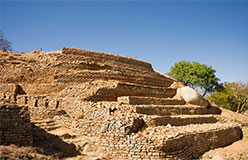
Khami Ruins National Monument is located to the west of the Khami River, 22 km from the City of Bulawayo. The property, located on a 1300 m hilltop downstream from a dam built during 1928-1929, covers an area of about 108 ha, spread over a distance of about 2 km from the Passage Ruin to the North Ruin.
The property was the capital of the Torwa dynasty, which arose from the collapse of the Great Zimbabwe Kingdom between 1450 -1650 and was abandoned during the Ndebele incursions of the 19th century. It is composed of a complex series of platforms of dry-stone walled structures, emulating a later development of Stone Age culture. The chief’s residence (Mambo) was located towards the north on the Hill Ruin site with its adjacent cultivation terraces. The population lived in daga huts of cobwork, surrounded by a series of granite walls. These structures display a high standard of workmanship, a great number of narrow passageways and perambulatory galleries and impressive chevron and chequered wall decorations. Khami conforms to Great Zimbabwe in a number of archaeological and architectural aspects but it possesses certain features particular to itself and its successors such as Danangombe and Zinjanja. Revetments or retaining walls found expression for the first time in the architectural history of the sub-region at Khami, and with it were elaborate decorations; it still has the longest decorated wall in the entire sub-region
Map
Visited 2863 times, 1 Visit today


